| News |
| Latest news | |
| Int’l Cooperation activities | |
| Events & Announcement | |
| Recent Activities |
| Location: Home>News>Recent Activities |
| Postseismic continuous GPS monitoring network installed at Yushu earthquake area |
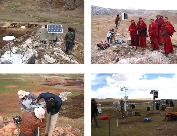
A continuous GPS monitoring network of 10 sites was set up in the Yushu area, Qinghai Province, to detect the Yushu earthquake postseismic deformation. The locations of the 10 GPS monitoring sites were designed to quantify the deformation along an over 200 km-long fault-perpendicular profile, with a few sites covering the dilatational and compressional zones at ends of the fault rupture. The network used the newly purchased Trimble NetR8 GPS system, which allows setting multiple sampling frequencies at the same time. Apart from the usual 15s-sampling interval, a higher 5 Hz sampling rate was used to try the “GPS seismology” in the earthquake-damaged Yushu region. Thus the GPS receivers would function similarly as broad-band seismometers if moderate earthquake (e.g., M>=5) occur in the region.
The Mw 6.9 Yushu earthquake was accompanied with a 60-70 km-long rupture, with 2-3 m left-lateral offset, on the northern section of the Xianshuihe fault. The coseismic deformation will perturb the lower crust and the mantle at depth, which would also propagate outward in the region surrounding the fault. Due to the smallness and “ephemeral” nature of this elastic signal, a high-density network and continuous GPS monitoring are needed for an effective detection. The installation, led by ITP Prof. LIU Jing, was a jointed effort of participants from Institute of Geology, Chinese Academy of Geological Sciences, and Bureau of Earthquake at Qinghai, and the California Institute of Technology. (news source: Prof. LIU Jing) |

